We Made It!!!!

20180409_123813-e1524070453543.jpg

Well, we made it. Two thousand, four hundred and something KM up the Carretera Austral, without a puncture or an accident. Through National Parks, across fjords, up volcanoes, past mudslides, in beautiful sunshine and horrible storms, past sparkling blue rivers and over high mountain passes. Five ferries, many litres of diesel, a few hitchikers, a number of shared meals, the odd panic, an even the occasional shower.

As is to be expected from such a capricious road, the end to our epic journey up the Carretera Austral was not simple. The route officially ends on the coast road in the centre of the unlovely city of Puerto Montt (or, as the locals apparently call it, Puerto Muerte). Turns out, the coast road is a three-lane monstrosity with no parking for miles.

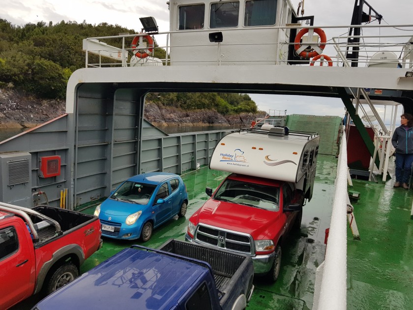
We boarded the last ferry this morning, enjoying watching seals frolicking in the sea below, hyped up knowing there were only 40-odd Km to go to ‘Kilometre Zero’ – or the start of the CA. Obviously, we were doing things in reverse, and ‘Km zero’ for us was actually ‘KM 2460’.

20180409_093017.jpg
Last ferry, and not long to go!!!!!

20180409_092137.jpg

Once we were off the ferry, we both counted down the KM marker signs at the side of the road – from 20 KM we shouted them out, over my ‘happy tunes playlist’. While the CA was only a section of this epic Argentina-and-Chile adventure, it was the most challenging, the most remote, and had the most bragging rights attached. Most people we met had not travelled the full length, and we were rightly proud of ourselves for ‘making it’ all the way from deepest, darkest, Villa O’ Higgins.

About 4km out of town, the traffic got a bit intense, and the marker signs disappeared. There were roadworks on the coast road, and total chaos getting into town. The CA was not going to make this easy, and we almost fell at this last challenge. We drove straight through town without even a peek of somewhere possible to park. Eventually finding somewhere to haul our monster of a van round, we headed back the other way, spotting the ‘Km zero’ sign at a busy junction outside a shopping mall, but I wanted photographic evidence. Lauren begged me to just give up and keep going, we knew we’d done it, why did we need a photo (she’s a mature child),  but no, I wasn’t going to be beaten at this stage. We would get to KM zero, and we’d pay proper homage to the road. People died making that road, and I’d put my all into finishing it – I was damned well going to celebrate the fact.

I may have got a bit grandiose….. she buried her head in her book…..

Eventually, we spotted a car park about 2km past the sign (on the other side of the 6 lanes of traffic, but still) and I carried out a probably-illegal manouvre to get there. We pulled in, I spotted a space…. Then the guard came and told us it was private, and no, we couldn’t just park there for ten minutes so I could take a photo….

I set off down the backstreets and found a spot eventually by some shacks, in a potholed lane full of stray dogs. It would have to do.

We yomped back to town, took the obligatory photos 

Then went for coffee and got the hell out of Puerto Muerte, thankful the van hadn’t been broken into.

We had a proper celebratory lunch in the much nicer Puerto Varas, less than an hour away, in an Irish pub named Pims, where we over-ordered Mexican food to such a degree that the leftovers were still being consumed two days later.

IMG-20180409-WA0002.jpg

Now, we have a gentle few days in the Chilean lake district – volcanoes and lakes, but with good roads – then a trek up to Santiago to return the van.

An Easy Day Sailing the Fjords

DSC02438.jpg

Today was a lot less about driving, and more about enjoying the beautiful fjords as someone else did all the hard work. The Carretera Austral has four ferries along its route, three of which in its northern tip where we are now.

The first ferry was small, and lasted only 45 minutes, from Caleta Gonzalo in the Pumalin National Park (previously owned by the founder of the North Face brand of clothing, now owned by the government, and beautiful) across to the other side of the fjord. We then had to drive 10km on a track that runs between two fjords, and is only accessible by boat (I like that, driving on a road that just exists in between two bits of water, totally inaccessible from other roads), and has no habitation whatsoever – there was a nice sense of camaraderie in the 20 or so vehicles who then waited two hours for ferry number 2, the 3-hour journey all the way down another majestic fjord.

There are no roads across this part of the country, so it’s the ferry or a many-hundreds of km detour through the Andes, into Argentina and back again.  In the queue were other overlanders – including one German couple who had a van from the same company as us, and a swiss couple we had met previously – a team from National Geographic, a group of motorcyclists, some cyclists and backpackers hitching lifts, truck drivers and local families. Lauren walked up and down the queue, enjoying the sweets she was given by the Nat Geo team, and stroking the dogs. Chileans seem to love their dogs and take them everywhere with them, and don’t seem to be at all upset when Lauren interrogates them on whether their dogs have had their vaccines and are safe to stroke before approaching (I’ve trained her well…. Or to be paranoid… ).

The highly efficient staff on the ferry got all the vehicles on safely, and we raced upstairs to try to find a socket to charge our various devices. That out of the way, we turned our attention to departure – we were just pulling out when we got a great sighting of dolphins playing in our wake, and generally having fun.

The scenery through the fjords was lovely, and you can see why people pay big money for ‘chilean fjord cruises’. Ours cost about 80 USD for the two ferries, for us plus the van.

DSC02423.jpg

20180408_115241.jpg

DSC02429.jpg

20180408_144748.jpg

20180408_175841.jpg

20180408_160350.jpg

We could see glaciers and frozen waterfalls, lots of fish, dolphins, birds etc. Although after a while, we went inside for lunch and Lauren convinced the poor German guy who we had met previously to play snap, endlessly. He has three daughters, now grown, and lots of patience! Despite his not speaking much English, Lauren nattered away to him happily for ages, seeming not to notice it was a rather one-sided conversation. 9 year old girls, eh!

20180408_152409.jpg

It was nearly 6pm when we disembarked, and so along with the German couple, we  agreed to cross the peninsular to the final ferry, but to camp before catching it, and carry on in the morning.

We believed it was tarmac and an easy 45 KM to where we planned to camp, but as ever the Ruta 7 had a surprise for us, and half the road was being dug up for improvements, and so we still managed to spend some quality time with the ripio. Plus three very long delays at road closures, meaning that by the time we arrived where we planned to camp, and realized it was not suitable, it was almost dark.

We backtracked to the village we’d passed a few KM up the road, and in the growing darkness, identified a spot on the cliffs that seemed not to be private property and seemed to be safe… it was so pitch black, we weren’t really sure where we were parking, or what we would find in the morning, but we had little choice, and so lined up our two rigs and we invited the Germans over for dinner (mainly on the basis that our van had heating and we’d been given an upgrade and they hadn’t and were surviving in a tiny little box on wheels). It was a pleasant evening over simple food and some good wine.

Next day – the end of the Carretera Austral!

Chaiten Volcano

20180406_093415
Chaiten village, with its fiery volcano in the background a constant smoky presence.

After the sobering experience of passing through Santa Lucia and the devastation caused by a massive mudslide, arriving in Chaiten was equally thought provoking. Ten years ago next month, the ‘mountain’ behind this small town erupted, making itself known as a volcano, much to the surprise of local residents and the Chilean government. Fair enough though, they estimate the previous eruption was 9000 years ago… .

All 4000 residents were promptly evacuated – including by force as many did not wish to leave. Their properties and animals were left to fend for themselves. There was looting. The whole town was covered in deep layers of ash, a la Pompei. While the lava did not wipe out the town, the ash was devastating and the government tried to relocate the community to a safer place, a few KM away.

Residents refused, and after a standoff, they won, with the government eventually re-connecting water and other services.

For us, despite being aware of the human tragedy, the main attraction was the possibility to climb to (almost) the top of the volcano, and get up close with the smoking, smouldering, beast.

I won’t lie. The climb nearly killed me, and I was in significant pain for days afterwards. I am not fit and have so many bits and bobs that don’t work properly, if I were a car I’d be scrapped.

However, I am determined, and when reading all the warnings about ‘high level of fitness required’ and ‘level of difficulty: difficult’ I blithely assumed that, you know, mind over matter and all that … I’d be fine.  I did tell Lauren there was no guarantees we’d make it etc etc – but in my head, it was a challenge and I would not be turning back unless it was actually dangerous.

It was a beautiful day, and I’d been watching the weather forecast for a couple of days to make sure we’d be there on the right day – for days before and after rain was forecast. We had a bag full of ‘trail food’ and water, as well as jumpers and waterproofs because despite the sunshine, this was still Patagonia.

The walk started off gentle enough – winding through gently sloping forest, crossing a river, before suddenly just going, straight up. And up. And up. And up.

20180406_162031

At times, there were little ladders.

It was very eerie walking through forests of dead trees – its long enough ago that the vegetation underfoot is once again lush and springy, and some new young trees have started to grow, but there are still hundreds of dead trees, still standing upright but totally dead. The obviously weren’t in the direct flow of the lava but I guess died from the gas/ash ….

20180406_102144

The worst part of the climb was that while at the bottom we had been able to see the smoking summit ahead of us, we were now just climbing and climbing through thick forest, with absolutely no view or ability to gauge how close we were getting (or not). We stopped for 10 minutes every 30 minutes, for water and a break. Lauren was of course fine, and for a while I was even enjoying the challenge. The last third though was a killer – at one point I was doing 50 steps, then stopping to take a breath, then another 50, then stopping.

Don’t get me wrong, other, fitter, younger people overtook us, although even they were struggling – but it was my fitness rather than the climb that was the problem… and Lauren often ran on ahead then scrambled about on the rocks picking up chunks of lava or examining bugs and flowers.

About ten minutes from the summit, we met a guy coming down who told me how close we were, and that spurred me on to one final effort, legs shaking, until the full volcano was visible in all its terrible glory.

The ‘new’ crater was 200m higher than the old summit, having been built up by the lava.

We spent about an hour up there, enjoying the magnificent views of mountains, lake and sea, as well as the two big lumps of the volcano, one with lots of smoke coming out of the top, the other with delicate tendrils of wispy smoke occasionally emerging from its sides and floating upwards. It was stunning.

20180406_13570020180406_13125420180406_140344

Going down was almost as hellish as going up, but with the promise of some mint tea and chocolate at the end.

It was worth it, even though my legs barely functioned for 2 days afterwards. And Lauren found some big chunks of lava, which added to the already not-insubstantial weight of our backpacks…

img-20180409-wa0004.jpg
So now we are carrying around lumps of lava….


A Moving and Sobering Day

20180405_174701.jpg
Scenes of devastation at Santa Lucia village.

This day started with me annoyed at something minor, and ended with us both chastened by the extremes of nature and how lucky we are. I decided after the beating we’d taken on the ripio over the last few days, it’d be a good idea to check the tyre pressure on the vehicle. I asked around and was told that COPEC, the ‘petrol station’  (a wooden cabin with one pump outside) had one of those air-thingies that check the pressure and pump it up if necessary.

After the usual rigmarole of getting the van ready for travel (take the table down, stow everything, check drawers are properly closed, turn off the water pump, make sure the waterproofs are in the car, etc) we headed over to COPEC, and asked if we could use the air thingy. Sorry – technical name? Air pump? Tyre pressure gauge?

No, we couldn’t – but the friendly attendant would do it for me.

Even better – I am happy to let people do things for me 🙂

Unfortunately, this approach didn’t work out so well, as despite confirming the tyre pressure as low in the first one he tried, he accidentally let a lot of air out. Hmm. Well, just fill it back up again please….. Oops, the air thingy couldn’t handle that kind of pressure, and neither it seemed could he, as he retreated to hide in the cabin and sent his friend out….

Friend had a go and also failed. Great. We now had three slightly underinflated tyres, and one massively underinflated one.

And no way to fill them.

Why had I been so bloody conscientious? They’d probably have been totally fine.

Lauren was lost deep in a book and barely looked up, while I paced up and down and tried to contact the van hire company. They have been exceptionally responsive on the small things – where to buy gas, which mechanic to use to check the chains etc – but this time neither phone number was answered and emails also went without reply. Not, looking back, that they could have done much.

Attendant’s friend told us about a gomeria (tyre place – every tiny village has a thriving gomeria in this part of the world) a couple of KM away, so we limped over there to see if it was open. It was just a guy’s house with a tyre painted yellow stuck on the driveway, but sure enough, when we pulled up, he emerged and fired up a diesel generator to run a more heavy-duty tyre thingy.

He put in what he thought, but then the on-board computer went beserk, flashing and saying all the tyres were the wrong pressure. He convinced me I needed to drive a bit to ‘let the sensors catch up’, so we drove about 10km out of town, before stopping for breakfast.  Computer still said no, so we backtracked to gomeria man, and he adjusted them again and again until computer didn’t say anything (which we took to be a ‘computer says yes’).

I was a bit annoyed – we didn’t end up setting off until after 11am after all this faffing – but we had loads of time, and I had built in all that time exactly for this kinds of situations, so we set off with a vague plan of heading north til we were tired.

After a couple of hours and a stop for a walk and some lunch, we came to a queue of traffic. It being unusual to see much traffic at all, I parked up and jumped out. There were 5 cars waiting at a lone traffic light, showing red. Some cars were unoccupied, and others had people asleep in them. This wasn’t going to be a 5 minute delay for roadworks.

Turns out, we had reached Santa Lucia, where three months before there had been a devastating and fatal mudslide, that killed 24 people and destroyed a number of houses and the local school. The army has been clearing the mud – since December – but there is still a lot to do, and the road is therefore only open for three one-hour intervals a day. We had missed the 1-2pm slot, and would have to wait til 6pm.

This could have been somewhat annoying, but the sheer scale of the disaster soon became clear, and was instead incredibly sobering. People didn’t have a chance. The vast amount of mud must have come down the mountainside with such force, it just pushed everything in its path in front of it. Utterly wrecked houses stood next to untouched ones, and you could easily make out the mud’s path. This is over three months before remember.

Every 3-5 minutes, a huge truck would carry another load of mud away from the site. The excavators worked constantly. One of the army guys we chatted to told us they worked 7 days a week, all day with the exception of those 3 one-hour intervals. And still, the mud was everywhere.

20180405_17142520180405_171154

20180405_172211
The church survived….. 

When we were eventually allowed through at 6pm precisely, it was in a stream of about 20 vehicles, and we were driving straight through thick mud – I only caught glimpses as I needed my eyes on the road, but as we climbed the mountain after the village, hundreds and hundreds of metres of forest was dead, and it was like driving through a scene from a horror film – at one point, on both sides, all you could see was total devastation and dark sticky mud.  The village was actually on the extreme edge of the flow – a bit further to the south and the whole village could have gone.

It was a sobering sight, and a reminder that Patagonia is no joke for the hardy people who make their homes here.

A long day on the Carretera Austral – North from Coyhaique

20180405_120728.jpg
One of the few times we could see anything but rain…… 

We left Coyhaique after filling up the car with fuel, the fridge with vegetables, and ourselves with pizza and cinnamon buns. We planned to stay the night in the Quelat national park, famous for its trek to a beautiful ‘hanging’ glacier. Not sure what a ‘hanging’ glacier is, but we were sure it’d be fun to find out.

The road remained tarmac for about 20 minutes, then we were back to our old friend the ripio. In actual fact, there is a tarmacked, slightly longer route, but undoubtedly quicker, but this would take us off the Ruta 7/Carretera Austral and we had vowed to drive every metre of this famous road.

Just because.

The area north of Coyhaique (what we could see of it amongst the dense rainclouds) was pretty but more developed than in the ‘deep south’. We saw farmhouses and fields with cows and sheep for a while, and I felt a little sad because it felt less remote, and I wondered if that would be it for ‘proper isolation’ on the CA. However, soon the mountains again closed in and we started winding up and down through deep valleys with steep sides of lush vegetation.

As we climbed up and up, I watched the outside temperature gauge drop from 8 degrees to 1, as the rain turned to hail and then to snow. The ripio gave way to slippery mud, which certainly made the steep descents interesting. There were regularly large rocks in the middle of the road, having detached themselves from the towering cliffs above. The wind was howling round the van, we were enclosed in clouds and being battered by rain/hail/snow slush, and even though it was barely mid-afternoon, it felt dark enough to be evening. There was nowhere safe to stop, visibility was minimal and I really started to worry about what would happen if the van let us down in some way. I could tell Lauren was also not enjoying this particular Ruta 7 challenge, from the deep silence emanating from behind me. Silence is rare in our household. She even talks in her sleep.

Eventually, after an exhausting and challenging drive, we made it to the park just before 5pm, having dropped down significantly in elevation and found some more (short lived) tarmac. Despite the miserable conditions, I was buoyed up to see the park ranger coming out of his little cabin. I love the national parks in Chile, they really do seem to want to make it as easy as possible for people to get out into the wonderful natural environment the country has to offer, and the rangers at the less well known parks seem positively delighted to have someone to talk to. So I was looking forward to a chat in his nice warm cabin, and a cosy campsite sheltered from the wind.

Nope.

Friendly ranger jogged over to us, holding his jacket over his head against the rain, and told us that due to rock falls and an avalanche, the park had been closed until further notice for the public’s safety. No cosy chat, no nice campsite, hiking trails and ‘hanging glaciers’ for us. A look at the map told us there was nothing much within an hour – in fact google maps and mapsme both showed the Carretera Austral heading straight through a long fjord. The ranger told us that had been when the road was closed due to rock falls, and a boat had been required – the road was now open but he told me to be very careful given the weather, as there had been reports of serious rock falls and damage on that section of road.

I don’t really know what to make of warnings of rock falls, as its not like you can avoid a rock if it starts careering into your path. I’ve often thought that in the UK when you see a sign warning of possible rock falls, but here it felt a little less of a joke. The road is cut straight into the rock face, and you drive between the side of the mountain and the fjord. There are passing points, but elsewhere its impossible to squeeze past another vehicle. How was I supposed to “watch out for rock falls?”. I was so tired, but the ranger strongly recommended we not wildcamp in these weather conditions, so we set off for the hour drive to the tiny village of Puyuhuapi. It was pretty wild, and I was flagged down by one of the guys doing some work on the track to be told, again, to be careful of the rock falls. In fact, I realized they really meant watch out for rocks that have already fallen as the track was littered with them, and in the gloom, and against the backdrop of ripio, it was actually very difficult to make them out. There were some monsters.

We found a campsite (well, it said camping but it was just a family who let people stay in their backyard and jump on their wifi), and after I maneuvered the van into the extremely tight space, Lauren doing a sterling job of directing in the pouring rain, which had been joined by thunder and lightning, we jumped in the back, put the heating on full, and collapsed on the bed. Sometimes its nice having your bed with you wherever you go 😊

OMG Tarmac!!!!

The last two days were a bit of a culture shock.

Driving  from Rio Tranquilo, we came to the worst section of road so far. It wasn’t scary-twisty-windy-mountain-edgy-sheer-drops bad, like the extreme south down to Villa O’ Higgins, it was just bone-rattlingly bumpy, incessant washboard that was so uneven and irregular there was no way to ever get into a rhythm.

I tried speed – impossible, too likely to skid; I tried just ambling along at 30 km/hr – awful, just bumps and the lack of speed just meant the van went sideways as much as forwards. I swear at times it actually jumped sideways. I tried driving with one wheel on the edge – but the edge kept falling away. There was nothing to do but just take it. Hours of juddering, headache-inducing, arm-wrenching, up and down dusty mess. And when it rained, hours of juddering, headache-inducing, arm-wrenching up and down muddy mess.

At least the scenery was, as usual, stunning (I need more words for stunning/beautiful/lovely, suggestions in the comments please). The autumn colours were particularly evident around Cerro Castillo.

20180402_1500503683097311366174761.jpg

20180402_151432648807322990472903.jpg

20180402_1541507948906175727084357.jpg

20180402_1514523992837473668336887.jpg

Then, just like that, when my arms were actually hurting from holding the wheel straight – we shuddered rounded a bend and hit tarmac.

I wasn’t prepared.

I wasn’t ready – it even had a yellow line down the middle and I couldn’t see a single pothole.

WTF? This wasn’t supposed to happen.

The feeling of relief mixed with resistance at such ease continued as we approached what turned out to be an actual ‘city’ (for Patagonia), Coyhaique. Population 50,000! How had I missed that?!

About 50 km out, we started passing farms – actual mechanized agriculture and houses. It was horrible! There were even flat bits. After all the nothingness and mountains, it suddenly felt like we were in Norfolk or something.

We found a campsite, and the next day, this feeling of slightly wide-eyed delight allied with unease continued – I had an actual latte made on a real coffee machine, rather than nescafe, with a cinnamon roll for breakfast. Lauren had French toast. With syrup! We went shopping and found green broccoli and red red peppers. We had pizza. (Yes, it was all about food). The ‘city’ had shops that went beyond basic necessities, and people with make up and smart clothes. I counted three pharmacies!

In the main square, there were buskers, guys passed out slumped on the floor, a (closed) tourist information office, free wifi and even a black woman! I felt like running up to her and hugging her, which i am sure she’d have found very strange bordering on racist. But cosmopolitan or what?! Mind you, the following sign reminded us that even in this thriving metropolis, and despite two weeks of driving north, we are still considered to be in the ‘deep south’ by Chilean standards. That’s a hell of a long way to go to Santiago…..

20180403_1256337474169674352656530.jpg
Quite a way to go, then……

It hasn’t really been that long, but we both were slightly conflicted and agreed to enjoy it all, stock up on vegetables, return for more latte and French toast tomorrow morning, then get the hell out of here and back to the Ruta 7.

Luckily, I hear the tarmac runs out again not far north.

My arms have almost recovered….

Bring it on.

The Marble Caves of Puerto Rio Tranquilo


Having been diverted by the walk to Rio Baker the day before, we were later than planned arriving in Rio Tranquilo, and I thought we might as well just take it easy and visit the main attraction – the so-called ‘marble caves’ on the lake – the next day. Unfortunately, a quick check of the weather forecast suggested the sun was unlikely to continue – the next 5 days were forecast for rain in Rio Tranquilo.

We had a truly awful meal in the only restaurant that was open (come on guys, its supposed to be ‘shoulder season’ not the middle of winter) which was probably not the best preparation for a very rough boat ride. Lauren had the toughest beef I’ve ever seen – she couldn’t cut it at all, I managed only by cutting tiny pieces at a time; I had slimy boiled chicken. Yuck. This has definitely not been a trip for gourmets, but even by the standards of this trip so far, this was a low point.

Then, bellies full of greasy, slimy, unpalatable fodder, we went off in search of a boat to take us to the caves.

The marble caves are natural caves formed along the edge of the Lago General Carrera, an enormous blue lake that feels more like a sea, and is divided between Chile and Argentina.

20180401_144822.jpg
Lago General Carrera. Its very blue. 
20180401_114414.jpg
Lago General Carrera – less blue as evening falls. Still beautiful.

Getting out to the caves was not too bad – the wind was at our backs and it was slightly choppy, but that just added to the excitement. Lauren enjoyed leaning over with her mouth open, drinking in the spray.

20180401_150838
Getting Wet….

The caves themselves were interesting – we went inside some on the boat and could touch the various different marble formations. They were pretty, but I wouldn’t have detoured off the Carretera Austral to visit them.

20180401_151407

20180401_152139

20180401_151934

20180401_150126

20180401_151807


20180401_145435.jpg

The boat trip back was great fun, bordering on really not fun at all.

Huge waves completely engulfed our small wooden boat as we headed directly into the patagonian wind. We all got soaked, and we came very close to the rocks at times – I kept reassuring Lauren that the ‘captain’ did this every day and knew what he was doing… but I was also deep breathing and keeping an anxious look out for the quay.

Once back on dry land, we retreated to a café for horribly sweet hot chocolate and stale cake. As I say, not a trip for gourmets.

We camped that night right on the beach, sheltered from the wind by two trees. It had definitely warmed up, and the few hundred km we’d travelled had definitely made a difference. Tucked up in bed, to the sound of the wind and the waves, we agreed we quite liked Patagonia.

But not the food.

20180401_165307.jpg
Our backyard for the evening… 

The Stunning Rio Baker

20180331_170712.jpg

For much of this day’s travels we ran alongside the river Baker, a stunning bright blue gash of colour through the greenery.

We passed some (you guessed it) beautiful scenery, including lakes the river feeds, a beautiful blue surrounded by mountains decorated by autumnal-coloured trees. The reds, yellows and greens of a Patagonia autumn are stunning. We passed through Cochrane, where we parked up in the square to cook lunch, then started heading further north than we’d been so far – it suddenly felt like we were making progress and we could do this! Santiago, here we come (in a couple of weeks…).

20180331_155108.jpg

20180331_125744.jpg

20180331_114740.jpg

20180331_110307.jpg

An hour or so after Cochrane, we saw a signpost for a hike to the confluence of two rivers – the Baker, that we had been following, and another. We decided on a whim to ditch our plans and go have a look.

The confluence wasn’t that exciting – a small brown river somewhat diluted the startling blue of the huge Baker – but the spot was beautiful and there was a small waterfall. It was a lovely sunny day and we just enjoyed the exercise and being out of the car.

20180331_165437.jpg
Another day, another stick…..
20180331_170341.jpg
If you look at the far side you can see the grey waters merging with the blue…. 

After we finished the hike we clearly couldn’t make the town we’d planned to stop the night in, so we decided to have our first ever wildcamping  night, tucked off the road down a track right by the river. We slept to the sound of it rushing by, and woke to the bizarre blue colour through the trees.

I’d been reluctant to camp far from people (although the only possible risk there could be in Patagonia is from other people, and that is so minimal its barely worth considering) but it was fine – I slept soundly, no one bothered us, and it was lovely to wake in the middle of nature with no one else around. Lauren could mess about in the woods (she has a collection of sticks and stones now that she plays with more than her phone, which is never charged or asked for) while I made us porridge, and then we sat outside, watching the river and eating breakfast.

Life is good.

We are so lucky.

Tortel

20180330_174651.jpg

Tortel is brilliant. Population around 500, anywhere else but the deep south of Patagonia it would have been ‘heritaged’ and touristed out of existence, turned into a caricature of itself like Dubrovnik or Venice (I know that will cause outrage amongst the Ennis’s, but seriously, when tourists outnumber locals and you have to go searching for ‘real life’ that’s not somewhere I want to be).

Tortel is a remote (but then again what isn’t around here) village on a fjord that (eventually) connects with the sea. It’s a fair detour off the Carretera Austral, but it was the closest village after the ferry coming from Villa o’ Higgins, and I’d heard from another traveler it was beautiful.

First I have to mention the drive up to Tortel. In a place of jaw dropping scenery, this was some of the most spectacular. If you ignored the snow on the mountains, you could imagine you were in Thailand – steep craggy limestone (?) cliffs falling directly down to azure water of lakes and rivers, with lush, richly green vegetation. It was raining and not great visibility and I was tired and frankly Lauren was losing patience with my photo taking, but still…. beautiful.

DSC02340

Once you get there, the entire place is built of wood, around a series of shallow coves, clutching onto the steep sides of the mountains. There are no cars, as there are no roads – everything is connected by (steep!) wooden walkways. We were told we could park up for the night at the town parking on top of the cliffs and set off to try to find a late lunch.

The small houses are built out of wood, on stilts, and burn wood fires. We saw one bakery, and one grocery store. The main ‘street’ is a wooden walkway hanging over the edge of the lake, on stilts, with incredibly steep side-walkways disappearing up the mountainside to residences and small shops. There are a number of ‘squares’ (wooden platforms over the lake, often with monuments and sculptures, and once with outdoor gym equipment). The main square has a naval building (wooden, two-story, locked with a sign in the window with the phone number of the guard on duty), a local council building, a library (every village seems to have a well-equipped library) and a school. Along the shore there were plenty of boats, some functional, some clearly long since left to rot. There was even a wooden cabin which was the ‘Department of Glaciers’ for a Chilean university, a few kayaks parked up outside.

20180330_175407.jpg20180330_173453.jpg20180330_173128.jpg20180330_172345.jpg20180330_172203.jpg20180330_170204.jpg20180330_152409.jpg20180330_145714.jpg20180330_175445.jpg

We didn’t have much luck at first finding somewhere to eat, we did pass a few comedores but they were all closed, and we were almost resigned to trekking back up the hill for pasta (again) in the van. We agreed to one last push up to a restaurant signposted from the main walkway. It was a steep climb, in the rain and I was seriously beginning to wonder how the residents of Tortel ever go anywhere, when we saw smoke coming from the restaurant – surely a good sign? We tried the door but it was locked, although we could see a couple eating in the gloom….. maybe they were the owners having an Easter Sunday lunch ….

Despondent, cold, and wet, we started back down the hill to walk the significant distance back to the parking area, by this time 3 coves away.

Suddenly we heard a voice from above – a guy of about my age with a shaggy beard and big woolly jumper was urging us back up the steps, telling us he was open.

We didn’t need telling twice.

Once seated it became clear there wasn’t a menu as such – he told us we could have conger eel soup or steak. We went for the steak, naturally. The place was like someone’s living room, with jazz playing on the stereo, easy chairs and tables, rather random artwork around… comfy, warm and welcoming.

I didn’t have high hopes for the food, but the steak was delicious, perfectly cooked as we asked (I order medium rare then I eat the outside bits and give Lauren the middle, bloody bits that she loves), beautifully seasoned, and – joy of joys – actually came with vegetables. A whole avocado between us (I got it all, Lauren says its yucky), sweetcorn, tomato, shredded carrot, beetroot and roast potatoes. What a feast. We have definitely been starved of veggies. I even got a berry smoothie.

The owner (he of the shaggy beard, even shaggier jumper and it turned out even shaggier dog) came over to chat – telling us he was from further north but fell in love with Tortel and moved here on a whim, barely breaking even but ‘enjoying the beauty’. He told us to connect to the wifi and stay all afternoon, to stay warm and enjoy the peace.  So we did, downloading a few audiobooks and enjoying being warm.

Around 5 the weather cleared, we bid farewell to our new friend and went for a walk down to the edge of the village and the beach, before heading back to the van for an early night.

We both have very warm memories of Tortel – such an unusual place but totally its own place – not tarted up for tourists (we saw no other foreigners there at all, and no Chilean tourists that we could identify), just getting on with life in its own, sleepy, way.

And of course, Tortel fed us well. That always helps.

Finally – Starting the Carretera Austral

Today was the day I’d been looking forward to for many months, and we’d been actively working towards for a couple of weeks. I wanted to do the whole of the Carretera Austral, and that meant working our way to its southern end, where we would start the 2200+km trip north to Santiago.

Technically the CA, or ruta 7, runs from Villa O Higgins in the south, to Puerto Montt in the north. That’s 1,240 Km of mainly unsealed, rural road, roughly running up and down through the Andes.

Despite starting our roadtrip south of the CA, there is the enormous southern ice field (basically, a big lump of ice, glaciers and mountains which are totally impassible) in between the very far south of Chile, where we collected the van, and the end of the CA. The rest of Chile is only accessible via Argentina (what we did) or by boat.

Anyway, here we were, fueled up, tyres checked, chains tightened (so we don’t lose the camper off the back of the truck on the mountain roads), extra diesel secured on the roof, supplies bought, odometer zeroed, devices charged, maps consulted, wildly differing electronic estimates of journey times consulted then ignored – as ready as we could be to get underway. Even though the first couple of hundred KM we’d be re-tracing our steps, this genuinely felt like the start of yet another adventure.

We waved goodbye to the various people we’d met and chatted to at the campsite, and left to a chorus of ‘good lucks’ and ‘see you on the road’ and ‘be careful on the bends’….. In our enormous 4 by 4 I felt a little bit of a fraud, as many of these guys were genuinely roughing it – some were even planning a 6 day walk through the mountains to Argentina, the only other way out of Villa O Higgins apart from the CA.

The weather was glorious and spirits were high as we set off.

I had promised to keep photo stops to a minimum, as the scenery is always stunning and you can never capture it properly on a camera, and we did have 1200+ KM to go, excluding the trip north after the CA to Santiago….. but just on the outskirts of the village is a beautiful lake, and I couldn’t help jumping out for a quick snap…..

20180330_102031.jpg

Later on, we stopped for a quick drink – Lauren reveling in the idea of drinking pure mountain water….. I told her it probably didn’t have too much guanaco poo in it….

20180330_110906.jpg

I had consulted the information I had for the ferry section, and though we’d arrive a couple of hours before the 4pm ferry – then we’d either wild camp or keep moving, depending on how tired I was. My memory of the journey down was of endless steep mountain trails, slippery in the rain, but we made much better progress on our return, mainly due to better weather conditions. I started to think we’d be super early, but no problem, we could park up and cook some lunch.

Around 12.15, we were overtaken by a fast moving truck – who almost lost control as he careered past us. Odd. There was no habitation between us and the ferry – and the ferry wasn’t until 4pm, right….?

It occurred to me to check, and sure enough, there was a 1pm ferry.

Ah.

Could we make it?

I decided we’d try. This was Chile – if there’s a ferry scheduled for 1pm, it’ll go at 1pm precisely – but if they see us coming, they’ll wait. Chile seems to get the balance right between organization and friendliness.

For the next 45 minutes, I balanced speed with safety – it was impossible to go faster than about 50km/hr safely, but I kept doing the calculations of average speed and km to go in my head, and was convinced we could make it, if I could just keep the average up….. Lauren kept track of our location on the gps, and I took every bend as fast as I felt was safe…. Which wasn’t very fast…. About quarter to 1, we suddenly met a stream of cars moving fast – clearly coming from the inbound ferry and not expecting anything to be on the road, as you are supposed to arrive at the ferry 15 minutes before departure…. Everyone careered into the ditches and kept moving, while I just sat there letting them go. Once they’d passed, we saw a 7km mark, and I thought we could make it…. I kept pressing on, ready to slam on the brakes should we come across a dawdler … we passed 7km, no ferry … 8km, still no ferry…. No time to stop and check the gps, anyway what good would that do, its not like there are multiple roads…..  at 8.5km the ferry came into view – but could they see us? It was now 5 to, or 3 to or 1 to depending on whether we believed the car clock, my watch or my phone….. I kept pressing on, round and round the muddy bends by the side of the lake, lauren telling me every minute what time each device thought it was (I bit my tongue).

We raced to the edge of the river at one minute to by my phone, which turned out to be the most accurate.  The same guy who’d been working a couple of days before on our outward journey was working and was laughing heartily as I spun the vehicle round and started reversing without taking breath…. They had to bring the boat closer to shore to make the angle of the ramp shallower, then we were on, no messing, and before I even turned the engine off we were a good few metres from the shore.

It was an unexpectedly stressful moment on the CA – but really not that stressful, because if we hadn’t made it we’d have just cooked lunch and played Uno til 4.

I love not having a real schedule 😊 .